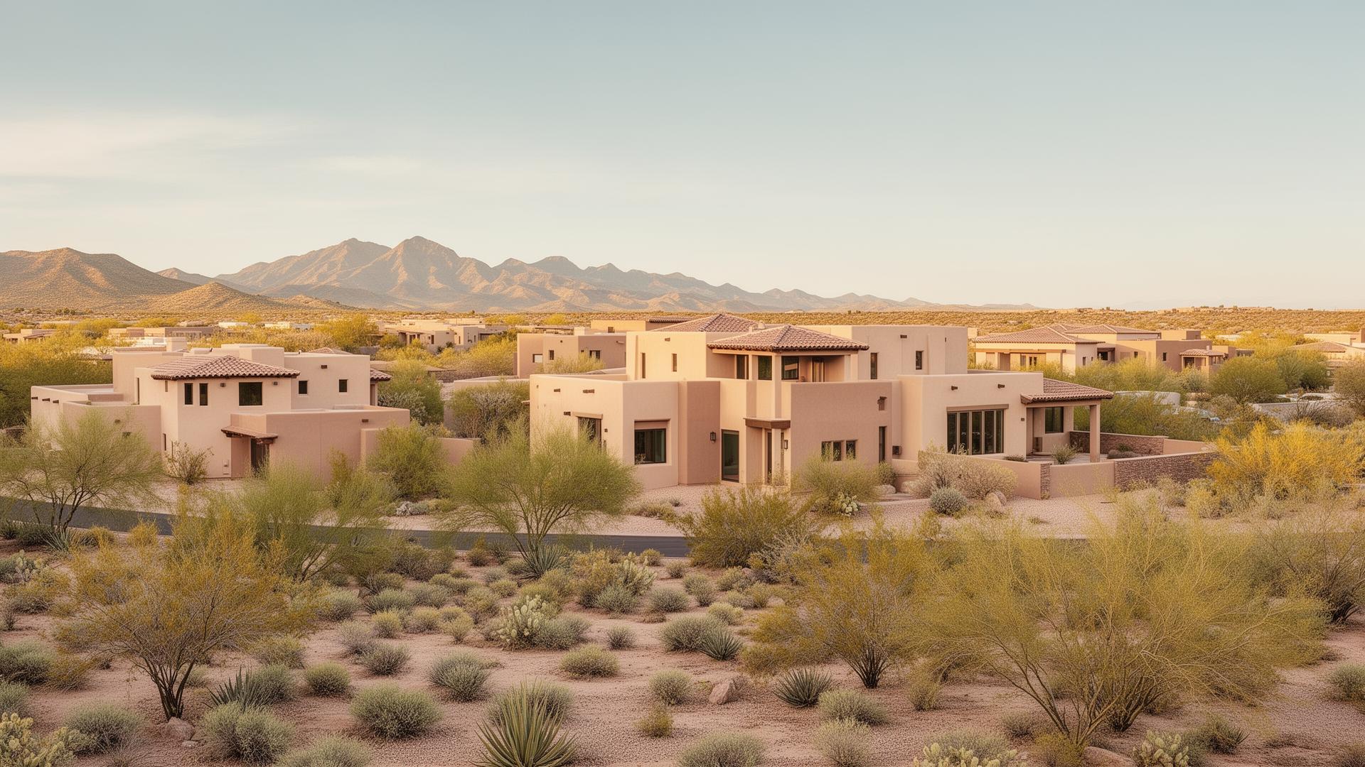
Arizona desert foothills streetscape representing Northeast Mesa housing character

Northeast Mesa, AZ

Where the East Valley meets the mountains.

Desert-edge living near Usery Mountain and the Tonto National Forest boundary, with established golf communities, gated sections, and Loop 202 access to the rest of the Valley.

Quick Answer

Is Northeast Mesa, AZ a Good Place to Live?

Northeast Mesa is an unofficial descriptive region covering communities around the Red Mountain, Las Sendas, Falcon Field, Usery Mountain, and Loop 202 corridors, and boundaries vary by source and local usage. Housing is largely established resale, with hillside and golf-oriented communities, gated sections, two long-standing age-restricted communities, and limited newer construction. Buyers here generally trade a longer westbound drive for proximity to the desert edge.

How this area is defined

Northeast Mesa is a description, not an official district

Northeast Mesa is an unofficial descriptive region covering communities around the Red Mountain, Las Sendas, Falcon Field, Usery Mountain, and Loop 202 corridors. Boundaries vary by source and by local usage.

Because the label is descriptive, different sources draw the edges differently, and no official population, boundary, or statistical data exists for the area on its own. City of Mesa figures apply to Mesa as a whole. Anything carrying legal or financial weight — school assignment, association documents, zoning, utility provider, tax parcel details — should be verified for the exact address rather than assumed from the area name.

Pricing, HOA assessments, utility providers, insurance considerations, and travel times vary by property and should be verified during due diligence.

Public-school attendance boundaries and program availability can change. Verify the current assignment for the exact property address with the applicable district.

Last verified · City of Mesa, Maricopa County Parks

Last reviewed: July 2026

Northeast Mesa at a glance

the numbers that actually matter

What it is
An unofficial descriptive region, not a designated municipal district of the City of Mesa. Boundaries vary by source and local usage.
General location
The northeastern portion of the City of Mesa, covering communities around the Red Mountain, Las Sendas, Falcon Field, Usery Mountain, and Loop 202 corridors.
Population
No official population figure exists for Northeast Mesa on its own. City of Mesa population data applies to Mesa as a whole, not to this sub-area.
Usery Mountain Regional Park
A Maricopa County regional park covering 3,648 acres, on the eastern side of the area.
Red Mountain Park
A City of Mesa park covering 1,146.3 acres.
Schools
Primarily Mesa Public Schools, with charter, private, and open-enrollment options. Attendance is assigned by exact address and can change.
Housing character
Largely established resale housing, including hillside, golf-oriented, gated, and age-restricted communities. Newer and infill construction is limited compared with the southeast Valley.
Freeway access
Loop 202 (Red Mountain Freeway) runs along the western and southern side of the area; US-60 is south of it.

The Relocation Guide

Northeast Mesa isn't the same decision as the rest of Mesa.

The relocation guide walks through how to weigh terrain, commute direction, and community type before you shortlist a neighborhood.

What Northeast Mesa is Known For

Northeast Mesa's character comes from geography: the desert edge, the terrain variation, the golf communities, and an aviation employment base most residential parts of the East Valley don't have.

Mountain & desert edge

The eastern side of the area runs up against Usery Mountain Regional Park and the Tonto National Forest boundary. Elevation change, desert views, and open terrain are part of the setting rather than a distant amenity.

Trail access

Usery Mountain Regional Park trails, the Hawes Trail Network, and Salt River access are all on this side of the city, which is a primary reason many buyers look here.

Established golf communities

Las Sendas, Red Mountain Ranch, Alta Mesa, Apache Wells, and Leisure World are all organized around golf. Access, membership, and pricing structures differ by property and should be confirmed directly.

Gated & custom sections

The housing mix includes custom, semi-custom, and gated sections. Street layouts follow terrain in parts of the area rather than a uniform grid.

Falcon Field & the Falcon District

Falcon Field Airport is a City of Mesa general-aviation airport and the anchor of an aviation and aerospace employment area, with an adjacent industrial and commercial district.

Loop 202 access

The Red Mountain Freeway runs along the western and southern side of the area, connecting to Tempe, Scottsdale, and the rest of the East Valley without relying on surface streets.

Neighborhoods

worth knowing about in Northeast Mesa

Housing overview

The housing types you'll actually find here

Northeast Mesa is not a single housing product. Eight distinct types sit inside the same descriptive region, and they behave differently on price, maintenance, association structure, and resale.

Established subdivisions

The largest share of housing. Built primarily between the late 1970s and the early 2000s, with mature landscaping and condition that varies property to property.

Custom & semi-custom homes

Individually designed and semi-custom plans, concentrated in the hillside and golf-oriented communities. Floor plans, finishes, and lot treatment differ substantially from home to home.

Hillside & view lots

Sections built into the foothills with elevation change, terraced pads, and retaining structures. What a given home sees depends on its position and orientation, so views should be confirmed on site.

Golf-adjacent homes

Homes fronting or backing courses at Las Sendas, Red Mountain Ranch, Alta Mesa, Painted Mountain, Apache Wells, and Leisure World. Frontage usually carries a lot price difference and its own maintenance considerations.

Gated sections

Gating is applied section by section rather than area-wide. Do not assume a parcel is gated from the community name; verify for the specific address.

Townhomes & condominiums

Attached product exists in scattered pockets, including within age-restricted communities. Ownership structure, insurance responsibility, and reserve funding should be reviewed in the association documents.

Age-restricted communities

Apache Wells and Leisure World are long-established age-restricted communities. Rules, ownership structure, and included services differ by section and must be verified for every intended occupant.

Newer & infill construction

Limited compared with the southeast Valley. Mountain Bridge is the most visible newer master plan; other newer homes appear as scattered infill or rebuilds rather than large active phases.

Coming from out of state? The relocation guide covers what desert construction, pools, and association structures mean for maintenance once you're here.

Parks & outdoors

Parks, trails and open space — and who manages them

Recreation here spans four different jurisdictions: City of Mesa parks, a Maricopa County regional park, federal land within the Tonto National Forest, and trail segments maintained by more than one entity. Rules, fees, and closures follow the managing agency, not the neighborhood.

Usery Mountain Regional Park — Maricopa County

A Maricopa County regional park covering 3,648 acres on the eastern side of the area, with hiking, equestrian use, camping, and an archery range. Fees, hours, and closures are set by the county.

Hawes Trail Network — multiple jurisdictions

A desert singletrack network used by mountain bikers, runners, and hikers. It crosses land under more than one jurisdiction. The City of Mesa maintains only about 0.92 miles of Hawes Loop Trail; Mesa does not manage the network as a whole.

Desert Trails Park — City of Mesa

A City of Mesa park covering 37.09 acres, used for everyday neighborhood recreation.

Desert Arroyo Park — City of Mesa

A City of Mesa park covering 58 acres, with open space and neighborhood recreation use.

Red Mountain Park — City of Mesa

A City of Mesa park covering 1,146.3 acres, with a fishing lake, athletic fields, and open recreation space.

Salt River & Tonto National Forest — federal

The Tonto National Forest is administered by the USDA Forest Service, and river recreation along the Salt River falls under federal and state rules. Permits, parking passes, and seasonal restrictions apply and change.

Regional lake recreation — federal & other agencies

Saguaro Lake and the other Salt River chain lakes sit northeast of the area within the Tonto National Forest. Access, fees, and boating rules are set by the managing agencies, not the City of Mesa.

Golf

Golf in Northeast Mesa

Several communities here are organized around courses, but owning a home in one of them does not automatically grant course access. Structures differ by club and change over time.

Community-organized courses

Las Sendas, Red Mountain Ranch, and Alta Mesa are organized around courses. Whether a resident can play, and on what terms, depends on the specific club structure rather than on owning a home there.

Age-restricted community golf

Apache Wells and Leisure World include golf within age-restricted communities. Configuration, resident access, and any additional fees differ between them and can change.

Access & membership structures

Course ownership in this area includes private, semi-private, and daily-fee arrangements. Membership categories, initiation costs, dues, and guest rules are set by each club and are separate from association assessments.

What to verify before writing

Confirm in writing what a specific membership includes today, whether it transfers with the property, whether it is mandatory, and how it interacts with the association assessment.

If golf is the reason for the move, the golf lifestyle guide covers how course access and membership structures differ between communities.

Employment

Falcon Field & the Falcon District

Falcon Field Airport anchors the area's main employment concentration. Employer rosters, headcounts, and rankings change frequently, so this section describes the type of activity rather than publishing figures that go stale.

Falcon Field Airport

A City of Mesa general-aviation airport on the north side of the area. It supports flight training, maintenance, charter, and aviation manufacturing activity, and it is the reason an industrial employment base sits inside a largely residential part of Mesa.

Falcon District employment area

The industrial and commercial district around the airport includes aerospace, defense-related manufacturing, aviation services, and light industrial users. Employer rosters and headcounts change, so treat any specific figure as time-sensitive.

Adjacent commercial activity

Independent restaurants, breweries, and service businesses have grown around the district. Tenants change; verify what is currently open rather than relying on a list.

Commuting out of the area

Many residents work outside Northeast Mesa. Loop 202 and US-60 carry most of that traffic toward Tempe, Scottsdale, Chandler, and Phoenix.

Healthcare

Hospitals and healthcare access

East Mesa has several hospital campuses and a distributed network of outpatient care. Facility names, ownership, affiliations, and service lines change periodically, so confirm current details directly with the provider and your insurer.

Banner Baywood Medical Center

A Banner Health hospital campus in Mesa serving the eastern side of the city. Service lines and emergency capabilities change over time; verify current services directly with the facility.

Banner Heart Hospital

A specialty Banner Health facility located on the same east Mesa campus area. Confirm current programs and admission pathways with the provider.

Mountain Vista Medical Center

A hospital in east Mesa. Ownership, affiliations, and service lines for Valley hospitals change periodically, so confirm current details before relying on them.

Outpatient & specialty care

Urgent care, imaging, dialysis, and specialty clinics are distributed along the Power Road and surrounding arterial corridors. Network participation varies by insurance plan and should be checked individually.

Transportation

Getting around and getting out

Freeway, arterial, transit, and air travel access, described by route rather than by drive time. Travel times vary widely by time of day, route choice, and construction, so test your own trip before committing.

Loop 202 (Red Mountain Freeway)

The primary freeway serving the area, running along its western and southern side and connecting toward Tempe, Scottsdale, and the Loop 101.

US-60 (Superstition Freeway)

South of the area, used for east–west travel toward central Mesa, Gilbert, Chandler, and the wider East Valley.

Power, Recker, Ellsworth & McDowell

The main arterials structuring the area. Power Road carries most commercial activity; Recker and Ellsworth run north–south; McDowell Road is the primary east–west arterial on the north side.

Falcon Field Airport

A City of Mesa general-aviation airport. It is not a commercial passenger airport, but it does generate aircraft activity that varies by location and time of day.

Valley Metro

Valley Metro operates bus service in Mesa; light rail serves west and central Mesa rather than this part of the city. Routes and spans change, so check current service for a specific address.

Airports for air travel

Phoenix Sky Harbor International Airport lies west of the area via Loop 202, and Phoenix-Mesa Gateway Airport lies to the southeast. Travel times vary widely by time of day, route, and construction.

Shopping & dining

Where everyday errands actually happen

Commercial activity here is organized along corridors rather than a single center. Individual tenants change, so this section describes the corridors instead of listing businesses.

Power Road corridor

The main commercial spine for this side of Mesa: grocery, pharmacy, home improvement, restaurants, and services concentrated along the arterial.

McKellips & Recker area

Neighborhood-scale retail and everyday services serving the Red Mountain and Painted Mountain areas.

Falcon District

A cluster of independent restaurants, breweries, and small businesses near Falcon Field. Tenancy turns over, so verify what is currently operating.

Regional shopping

Larger regional retail centers sit outside the area, primarily south along the US-60 corridor and north toward Scottsdale via Loop 202 and Loop 101.

Utilities & moving logistics

Verify utilities by exact address

Utility assignment in Mesa is parcel-specific. Two homes on the same street can have different electric providers, different irrigation rights, and different broadband options.

Electric service varies by address

Parts of Mesa are served by the City of Mesa's municipal utility and other parts by Salt River Project. Provider assignment is set parcel by parcel, so confirm it for the exact address rather than the neighborhood.

Water, sewer & solid waste

Typically City of Mesa services within city limits, but service availability and connection status differ by parcel, particularly on older or larger lots.

Gas, internet & irrigation

Natural gas availability, broadband providers, and any flood-irrigation rights differ block to block. Verify each individually before assuming continuity from your current home.

Association & municipal setup

Transfer fees, association account setup, permit history, and any special assessment districts should be reviewed during the inspection period. Pricing, HOA assessments, utility providers, insurance considerations, and travel times vary by property and should be verified during due diligence.

Climate & desert homeownership

Practical considerations for desert properties

Climate matters here mainly through maintenance. These are practical items to evaluate on a specific property, not general claims about the area.

Summer heat and cooling systems

Extended high summer temperatures place sustained load on cooling equipment. Age, service history, and remaining service life of HVAC systems should be evaluated through inspections and records.

Monsoon season

Summer storms bring wind, dust, and short high-intensity rainfall. Roof condition, drainage paths, and grading are practical items to review, particularly on hillside lots.

Desert landscaping

Most properties use desert-adapted landscaping and drip irrigation. Timers, valves, and emitters are routine maintenance items, and hillside lots add retaining and erosion considerations.

Pools, exteriors & sun exposure

Sun exposure affects paint, roofing materials, and pool equipment life. Orientation and shade differ by lot, so treat these as property-specific rather than area-wide.

Also worth knowing

Other names you'll hear in this part of Mesa

Local usage also includes names such as The Groves, Las Palmas, Desert Uplands, Boulder Mountain Highlands, Estates at Hermosa Ranch, University Manor, and the Red Mountain corridor. These are subdivision or corridor labels rather than defined districts, and we have not published dedicated pages for them yet.

If one of them is on your list, ask directly — the practical questions (association structure, build era, lot conditions, utility provider) are the same regardless of what the area is called.

Ask about these areas

The Honest Pros & Cons of Living in Northeast Mesa

Northeast Mesa is the desert-edge portion of Mesa, oriented toward Usery Mountain Regional Park, the Tonto National Forest boundary, and the Salt River. Terrain varies from flat interior streets to hillside sections with elevation change, and the housing mix includes established subdivisions, gated sections, golf-adjacent homes, and age-restricted communities. It is a specific set of tradeoffs rather than a general recommendation.

The Pros

  • Mountain and desert views from many streets, though what any individual home sees depends on lot position and orientation
  • Direct access to Usery Mountain Regional Park (Maricopa County), the Hawes Trail Network, and the Tonto National Forest boundary
  • Several established golf-oriented communities, including Las Sendas, Red Mountain Ranch, and Alta Mesa
  • A mix of gated, custom, and semi-custom housing distinct from newer flat-grid master plans elsewhere in the Valley
  • Loop 202 (Red Mountain Freeway) along the western and southern edge for access to Tempe, Scottsdale, and the wider East Valley
  • Falcon Field Airport and the surrounding Falcon District support an aviation and aerospace employment base
  • Established landscaping and mature tree canopy in many of the older subdivisions

The Trade-offs

  • The area sits on the eastern edge of the metro, so trips toward downtown Phoenix or the West Valley cover more distance
  • Hillside and view lots typically price above comparable interior lots elsewhere in Mesa
  • Much of the housing stock is established rather than new, and condition varies property to property
  • Association structures differ sharply between communities; assessments and included services must be reviewed per community
  • Day-to-day errands generally require a car; there is no dense central retail core inside the area
  • School attendance boundaries vary across the area and can change, so verification by exact address is required
  • Some sections sit under Falcon Field flight paths; verify aircraft activity for a specific address
Working & Commuting

Working in Northeast Mesa

Northeast Mesa sits on the northeastern edge of the metro, so commute planning is mostly a question of direction. We don't publish fixed drive-time figures — they vary too widely by time of day, route, and construction to be useful. Use the routes below for orientation and test your own trip at your real departure time.

Tempe / ASU area

Loop 202 west

The most direct freeway direction from Northeast Mesa. Travel times vary by time of day, route, and construction.

Scottsdale

Loop 202 to Loop 101

A freeway-to-freeway connection toward north Valley employment, dining, and medical facilities.

Chandler & the Price Corridor

Loop 202 to Loop 101 south

A diagonal crossing of the East Valley. Test the route at your actual departure time before committing.

Gilbert

South via Power or Higley

Surface-street or freeway options depending on the destination within Gilbert.

Downtown Phoenix

Longest of the common routes

The main distance tradeoff of the eastern edge of the metro. Plan around it rather than assuming it will be fine.

Phoenix Sky Harbor

Loop 202 west

A mostly freeway route from this side of the East Valley. Travel times vary by time of day and construction.

The single most useful step before choosing this area: drive your actual commute, on a weekday, at the time you would really be leaving.

Northeast Mesa School Districts

Northeast Mesa is served primarily by Mesa Public Schools, with charter, private, and open-enrollment options available across the city. We don't publish school ratings or rankings — they change and are measured differently by different sources. Public-school attendance boundaries and program availability can change. Verify the current assignment for the exact property address with the applicable district.

Mesa Public Schools

K–12

Public district
ServesMost of Northeast Mesa, including much of the Red Mountain, Las Sendas, and Falcon Field areas
Worth knowingArizona's largest public district by enrollment, covering most of the city. Attendance areas are assigned by exact address and can be adjusted between school years.

Neighboring districts on the outer edges

K–12

Public district
ServesSelected addresses near the outer boundaries of the area
Worth knowingA small number of addresses on the outer edges fall outside Mesa Public Schools. Confirm the assigned district for the specific parcel rather than the neighborhood name.

Charter, private & open-enrollment options

Varies

Alternative options
ServesAvailable across Mesa and the wider East Valley
Worth knowingArizona has broad open enrollment and a large charter sector, so the assigned neighborhood school is one option among several. Availability, transportation, and application timelines vary by school.

School boundaries can shift year to year. Always confirm a specific address with the district before purchase, happy to help you verify.

Methodology & sources

How this page is researched and maintained

This guide prefers official and primary sources: the City of Mesa for parks, utilities, airport, and municipal information; Maricopa County Parks and Recreation for regional park data; the USDA Forest Service for Tonto National Forest land; Mesa Public Schools and the applicable district for school attendance; Valley Metro for transit; and each hospital system, club, or association for its own current terms.

Facts that change frequently — pricing, inventory, association assessments, membership costs, employer headcounts, drive times, tenant lists, and school ratings — are described in general terms rather than published as figures. Where a number is given, it comes from a named jurisdiction and is stated with that jurisdiction attached.

Photography on this page and on the linked community pages is illustrative of regional desert housing character. It is not documentary photography of a specific street, property, or community.

Pricing, HOA assessments, utility providers, insurance considerations, and travel times vary by property and should be verified during due diligence.

Public-school attendance boundaries and program availability can change. Verify the current assignment for the exact property address with the applicable district.

Last reviewed: July 2026
Still deciding

Gilbert vs. Chandler vs. Northeast Mesa

Three different versions of East Valley life. Compare them side by side on lifestyle, commute direction, and the kind of neighborhood you'd actually be living in.

Northeast Mesa Questions

answered honestly

Northeast Mesa is an unofficial descriptive region covering communities around the Red Mountain, Las Sendas, Falcon Field, Usery Mountain, and Loop 202 corridors. Boundaries vary by source and by local usage. In practical terms, it refers to the northeastern portion of the City of Mesa, extending toward Usery Mountain Regional Park, the Salt River, and the Tonto National Forest boundary.
No. The City of Mesa does not designate Northeast Mesa as an official municipal district. It is a descriptive label used by residents, agents, and local businesses. Anything with legal or financial weight should be verified against the specific parcel rather than the area label.
There is no single agreed boundary. Different sources include or exclude different corridors depending on how they use the term. Most usage centers on the Red Mountain, Las Sendas, Falcon Field, Usery Mountain, and Loop 202 corridors, but the edges are a matter of local usage rather than an official line.
There is no official population figure for Northeast Mesa on its own, because it is not an officially defined area. City of Mesa population data applies to Mesa as a whole. Any number presented specifically for Northeast Mesa reflects a boundary someone drew.
The mix includes established subdivisions, custom and semi-custom homes, hillside and view lots, golf-adjacent homes, gated sections, some townhomes and condominiums, two long-established age-restricted communities, and a limited amount of newer or infill construction.
Only a limited amount. Mountain Bridge is the most visible newer master-planned community, built largely from around 2010 onward. Beyond that, newer homes tend to appear as scattered infill or rebuilds rather than large active phases, unlike the southeast Valley.
Usery Mountain Regional Park is a Maricopa County regional park covering 3,648 acres. Red Mountain Park is a City of Mesa park covering 1,146.3 acres. Desert Arroyo Park covers 58 acres and Desert Trails Park covers 37.09 acres, both City of Mesa parks.
The Hawes Trail Network crosses land under more than one jurisdiction and is not managed as a single system by the City of Mesa. Mesa maintains only about 0.92 miles of Hawes Loop Trail. Trail conditions, closures, and rules can differ depending on which jurisdiction a segment sits within.
Hiking, trail running, mountain biking, and equestrian use at Usery Mountain Regional Park and along the Hawes Trail Network; neighborhood recreation at the City of Mesa parks; and river and lake recreation along the Salt River and the Tonto National Forest lakes northeast of the area.
The Tonto National Forest is administered by the USDA Forest Service, a federal agency, and river and lake recreation within it is governed by federal and state rules rather than City of Mesa or Maricopa County rules. Permits, passes, and seasonal restrictions apply and change.
Golf is a defining feature of several communities here, including Las Sendas, Red Mountain Ranch, Alta Mesa, Painted Mountain, Apache Wells, and Leisure World. Course ownership includes private, semi-private, and daily-fee arrangements, and resident access is not automatic.
Not necessarily. Club membership and course access are typically separate from association assessments, and terms differ by club. Confirm in writing what a membership includes today, what it costs, whether it is mandatory, and whether it transfers with the property.
Yes. Apache Wells and Leisure World are long-established age-restricted communities, both with golf and shared facilities. Age-restriction rules, ownership structure, and what assessments include differ between communities and between sections, so verify for the exact property.
Falcon Field Airport and the surrounding Falcon District form the main employment concentration, with aviation services, aerospace and defense-related manufacturing, and light industrial users. Specific employer rosters and headcounts change, so treat any figure you find as time-sensitive.
Falcon Field is an active general-aviation airport, so aircraft activity is present in parts of the area. Exposure depends on the specific address, flight paths, and time of day. Visit at different times and review any airport-related disclosures for the property.
East Mesa is served by facilities including Banner Baywood Medical Center, Banner Heart Hospital, and Mountain Vista Medical Center, along with outpatient and specialty clinics distributed along the arterial corridors. Service lines, affiliations, and insurance networks change, so verify current details directly.
Loop 202 (Red Mountain Freeway) serves the western and southern side of the area and US-60 runs south of it. Power, Recker, Ellsworth, and McDowell are the main arterials. Valley Metro operates bus service in Mesa; light rail serves west and central Mesa rather than this area.
Phoenix Sky Harbor International Airport lies west of the area via Loop 202, and Phoenix-Mesa Gateway Airport lies to the southeast. Falcon Field is a general-aviation airport rather than a commercial passenger airport. Travel times vary by time of day, route, and construction.
The Power Road corridor carries most everyday shopping and services, with additional neighborhood retail around McKellips and Recker. The Falcon District near Falcon Field has a cluster of independent restaurants and breweries. Tenancy changes, so verify what is currently operating.
Most of the area falls within Mesa Public Schools, with charter, private, and open-enrollment options available. Public-school attendance boundaries and program availability can change. Verify the current assignment for the exact property address with the applicable district.
Utility providers vary by parcel. Parts of Mesa are served by the City of Mesa's municipal utility and other parts by Salt River Project, and natural gas, broadband, and irrigation rights differ block to block. Confirm each provider for the exact address.
Sustained summer heat, monsoon wind and rain, desert landscaping systems, and sun exposure all affect maintenance. Condition and remaining service life of roofing, cooling, plumbing, and pool equipment vary by property and should be evaluated through inspections and records.
Gilbert and Chandler are flatter, more centrally located within the East Valley, and denser in retail, dining, and employment. Northeast Mesa has more terrain variation, more direct desert and trail access, and a larger share of golf-oriented and age-restricted communities. The right choice depends on commute direction and how the household uses weekends.
No. Mesa is Arizona's third-largest city and varies substantially by area. Northeast Mesa is one sub-market within it, with its own housing stock, terrain, and community types. For a citywide view, the full Mesa guide is the better starting point.
Pricing, HOA assessments, utility providers, insurance considerations, and travel times vary by property and should be verified during due diligence. Also confirm association documents and assessments, gating, golf or club membership terms, age-restriction rules where they apply, utility provider assignment, and school attendance for the exact address.

Information provided for general guidance only. Market data, pricing, and statistics are approximate and subject to change. All details should be independently verified before making decisions.

Take the next step

Two reads that help before you tour Northeast Mesa

Start here

The Relocation Guide

Don't pick the wrong East Valley city

Most out-of-state buyers shortlist the wrong neighborhood first. The guide walks you through how to choose the right city, set realistic expectations, and avoid the moves people regret in year two.

The Golf & Lifestyle Guide

Pick the wrong golf community and you'll feel it daily

Course photos all look the same. Daily life in each community doesn't. The guide compares East Valley golf communities by lifestyle, so you pick the one you actually want to live in.

Considering Northeast Mesa?

Let's figure out
if it actually fits.

Haylee works across Gilbert, Chandler, and Northeast Mesa every week. One conversation is usually enough to know whether the foothills side of the East Valley fits your budget, your commute, and your weekends.

Talk with Haylee

Haylee Duran · Real Broker LLC · Serving the East Valley